 It was fun to drive through the Gorge with friends relatively new to the state (both Nick and Tyler came to Oregon from the Midwest) and hear their excitement and awe over the nature that I (a sixth-generation Oregonian) tend to take for granted.
We soon arrived at the crowded Wahclella Falls trail head, donned our hiking boots and packs, crossed the bridge over Tanner Creek and started up Gorge Trail #400. The trail climbs quickly above the creek before turning back toward the river and leveling out next to the freeway.
After about 1 mile, the Munra Point Trail (unofficial and marked only with pink surveyor's tape) heads off to the left. This is a different junction than when we did this trip several years ago when it was a little-known scramble. While it's still unofficial and unmaintained, it's gained in popularity and is now much more obvious. But the trail also now offers a web of different routes on the way up, causing some confusion. But we just kept going up and up and up (seemingly straight up for about a mile).

 The trail comes out at several clearings, offering great views and some steeps drops. In some spots, hands are needed to get up the rocks.
  Just below the summit, you have to climb a nearly vertical chimney with rocks, mud and trees to navigate:
 But after that, you come out to spectacular views up and down the Gorge, including the Bonneville Dam and Hamilton and Table mountains directly across the Columbia River (and Mount Adams on a clear day). We walked out the eastern/northern ridge for a snack break, but we didn't stay long because of the chilly wind:
  Then we had to tackle the rocky summit block:
  The boys on top:
  Aren't we cute?!
 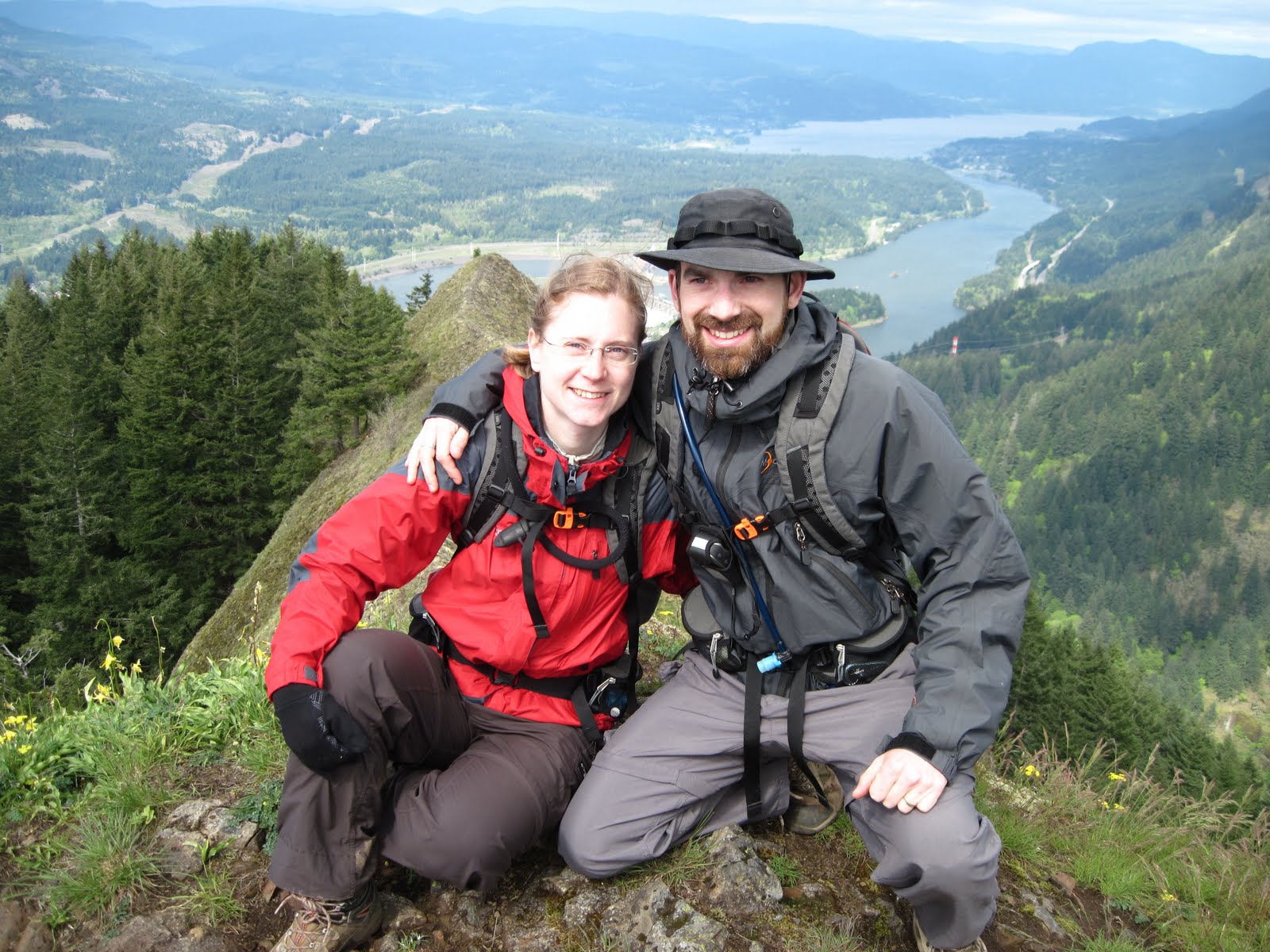 We made it up in about 1.75 hours. The way down isn't a whole lot faster since steep and rocky parts must be down climbed. Including our brief rest stop at the top, the entire round trip took just over 3.5 hours.
 This is a hard scramble with lots of exposure and poison oak. I would definitely not recommend it for those with a fear of heights and/or unsteady feet. And because of the slippery rocks, this is a dry-day hike. But if you're sure on your feet, not afraid of some dropoffs and ready to get your heart pumping and quads moving, this is a very fun, half-day adventure.
:)
No comments:
Post a Comment